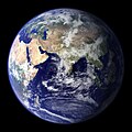
Skeda:BlueMarble-2001-2002.jpg

Madhësia e këtij shikimi: 800 × 400 pixel. Rezolucione të tjera: 320 × 160 pixel | 640 × 320 pixel | 1.024 × 512 pixel | 1.280 × 640 pixel | 2.560 × 1.280 pixel | 4.096 × 2.048 pixel.
Dokument origjinal (4.096 × 2.048 pixela, madhësia e skedës: 1,22 MB, tipi MIME: image/jpeg)
Historiku i dosjes
Shtypni një datë/kohë për ta parë skedën ashtu si dukej në atë kohë.
| Data/Ora | Miniaturë | Përmasa | Përdoruesi | Koment | |
|---|---|---|---|---|---|
| e tanishme | 20 dhjetor 2009 22:14 |  | 4.096 × 2.048 (1,22 MB) | Apoc2400 | High resolution. |
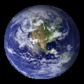
| 3 shtator 2005 02:10 |  | 405 × 203 (19 KB) | Saperaud~commonswiki | NASA created these two images to exhibit high-resolution global composites of Moderate Resolution Imaging Spectroradiometer [http://modarch.gsfc.nasa.gov (MODIS)] data. The land surface data were acquired from June through September of 2001. The clouds we |
Përdorimi i skedës
faqe lidhet tek kjo skedë:
Përdorimi global i skedës
Kjo skedë përdoret nga Wiki të tjera në vijim:
- Përdorimi në af.wikipedia.org
- Përdorimi në ar.wikipedia.org
- Përdorimi në ast.wikipedia.org
- Përdorimi në az.wikipedia.org
- Përdorimi në ba.wikipedia.org
- Përdorimi në be.wikipedia.org
- Përdorimi në bh.wikipedia.org
- Përdorimi në bn.wikipedia.org
- Përdorimi në bo.wikipedia.org
- Përdorimi në bs.wikipedia.org
- Përdorimi në ca.wikipedia.org
- Përdorimi në cs.wikipedia.org
- Përdorimi në cy.wikipedia.org
- Përdorimi në da.wikipedia.org
- Përdorimi në de.wikipedia.org
- Përdorimi në diq.wikipedia.org
- Përdorimi në el.wikipedia.org
- Përdorimi në en.wikipedia.org
- Marine biology
- Environmental movement
- Environmental science
- Twin Earth thought experiment
- Underwater environment
- The Blue Marble
- Ecosystem diversity
- Habitable zone
- Environmental history
- Origin of water on Earth
- Portal:Marine life
- Portal:Environment
- Portal:Environment/Selected article
- Portal:Environment/Selected article/14
- Sea
- Talk:Sustainability/Archive 8
- User:Nick carson/sandbox
- Talk:Sustainability/Lead
Shikoni më shumë përdorim global të kësaj skede.


